Tweed's flood planning controls
This project has now closed. The draft Interim Flood Planning Levels Policy was on public exhibition from 22 October 2025 to 23 January 2026. See the update below for the community engagement summary.
You can view the current Interim Flood Planning Levels Policy via Council's website.
Thank you for having your say
The draft Flood Planning Controls were on public exhibition from 22 October 2025 to 23 January 2026. During this time, 1,500 people visited the project page, 269 downloaded the draft policy, 4 completed the survey form and 5 provided direct email submissions. In addition to these submissions, we:
- Hosted five drop‑in sessions across the Tweed and online.
- Engaged with community leaders to review real examples of the proposed changes at a resident and ratepayer group forum.
- Presented the proposed changes to planning and building professionals working in the Tweed.
We’re now reviewing all feedback received and will use it to help shape the final version of the policy.
We’re updating our flood planning controls and we want to make sure we’ve got it right. That’s why we’re inviting you to have your say. Your local knowledge and lived experience are key to helping us better protect our community from future flood risks.
These updates will help ensure new homes and buildings are built above known flood levels, with a lower risk of flooding and greater resilience to climate change. Your feedback will help finalise both the Interim Flood Planning Levels Policy and the proposed updates to the Development Control Plan Section A3 – Development of Flood Liable Land (DCP-A3) (supporting files are listed under 'Documents' on this page).
We’re seeking your feedback on the draft:
- Interim Flood Planning Levels Policy – sets the minimum height for new homes and buildings to reduce flood risk.
- DCP-A3 (supporting files are listed under 'Documents' on this page) – outlines how and where development can happen in flood prone areas.
These updates respond to the 2022 flood event and incorporate new data from the Tweed Valley Flood Study Update and Expansion 2024. They also include allowances for climate change to ensure new development is safer and more resilient.
Why is this happening?
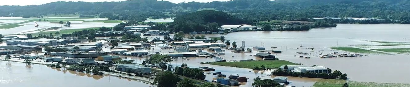
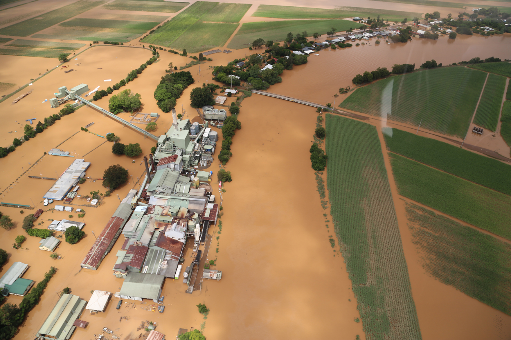 Aerial view around the Condong sugar mill and surrounding farmland during the February 2022 flood.
In 2022, parts of the Tweed experienced flooding that went above the levels we plan for. We've now completed a new flood study with updated data and mapping, including climate change projections. These changes will help make sure new buildings are better protected from flooding and future climate impacts.
Flood planning levels are usually set through a detailed process called a Flood Risk Management Study. We've started updating these studies, but they will take several years to complete. While this work is underway, we’re exhibiting the draft Interim Flood Planning Levels Policy to guide development decisions in flood-prone areas. This policy is now open for community feedback.
We’re also proposing updates to DCP-A3 (supporting files are listed under 'Documents' on this page). The draft is now on public exhibition at the same time and we’re inviting your input to help finalise the changes.
What's changing?
- Flood planning levels (minimum floor levels) will be based on the highest of:
- 2009 flood study 1% AEP (old level)
- 2024 flood study 0.2% AEP (as an allowance for climate change)
- the flood of record (e.g. 2022, 2017, 1989, 1954)
- a minimum 2.9 m AHD (to account for sea level rise)
- 0.5 m freeboard.
- Updates to various DCP-A3 controls and flood hazard mapping.
Explore changes in your area

Use the interactive flood planning map to see how the proposed planning controls may apply to your property or area. The map shows current and proposed flood planning levels and development controls under Section A3 of the Development Control Plan – Development of Flood Liable Land.
The interactive map is best viewed on a desktop, tablet or a device with a bigger screen. It's not designed for mobile use due to the level of detail and data displayed.
Overview of the interactive map
The main navigation on the left-hand side of the page will provide you with the following information:
- Proposed Defined Flood Event (DFE)
The DFE is the flood event used as a general standard for managing flood risk to development. It is usually based on floods of a specific Annual Exceedance Probability (AEP), significant historical events, or a combination of both. The proposed DFE is shown on the map in metres (m AHD), which means height above sea level. - Proposed Flood Planning Level (FPL)
The FPL combines the DFE with a freeboard – a safety margin to provide reasonable certainty that the selected risk exposure is achieved. In Tweed Shire, the freeboard is 0.5 metres and is added to the DFE level. This is also shown in m AHD. - Proposed Probable Maximum Flood (PMF)
The PMF represents the largest flood that could conceivably occur at a location – a catastrophic event with very low likelihood. Updates to PMF mapping apply to the Tweed Valley Flood Study Update and Expansion 2024. Coastal Creeks PMF mapping remains unchanged. - Proposed High Flow
These are areas of the Tweed Valley and Coast Creeks floodplain that carry most floodwaters. Obstructions here can worsen upstream flooding. DCP-A3 limits fill and building in these areas. Updates to high flow area mapping are limited to the Tweed Valley and result from the Tweed Valley Flood Study Update and Expansion 2024. Coastal Creeks high flow area mapping remains the same. - Flood Hazard Category
Hazard categories combine flood function and hazard mapping to classify areas as floodway, high hazard flood storage, low hazard flood storage or flood fringe. Certain high-risk areas prohibit development such as dual occupancy or secondary dwellings under DCP-A3. - Defined Flood Event Source
For information only. Shows the historic or design event that forms the basis of the proposed DFE and FPL. - Change in Defined Flood Event
For information only. Shows differences between current and proposed DFE levels. Areas upstream of Murwillumbah appear blue (“Was Dry Now Wet”) because previous mapping did not cover these areas. - Current DCP - A3 Mapping
Existing maps provided for comparison. Multiple maps are available in the right panel.
Tips for using the interactive map
- Best viewed on desktop, tablet or device with bigger screen (not designed for mobile).
- Click the search icon (top right) to find an address.
- Use the left menu to switch between views.
- Search address first, then select views to see data for your location.
Community drop-in sessions
 Join us at a community drop-in session this November to learn about the interim policy and changes to DCP-A3.
In addition to the draft Interim Flood Planning Levels Policy and the proposed updates to the Development Control Plan Section A3 – Development of Flood Liable Land (supporting files are listed under 'Documents' on this page), the Development Control Plan is also being reviewed to simplify the document and create a more user-friendly resource for the community and stakeholders.
The community drop-in sessions are your opportunity to speak with Council staff and learn more about the:
- draft Interim Flood Planning Levels Policy
- proposed changes to Section A3 of the DCP – Development of Flood Liable Land
- draft changes to the overall Development Control Plan – visit the Development Control Plan draft improvements page for more details about this project.
Drop-in session dates:
Tuesday 11 November – Uki Public Hall, 10:30 am – 12 noon
Thursday 13 November – Murwillumbah Civic and Cultural Centre, 10 am – 11:30 am
Tuesday 18 November – Tweed Heads Council Office, 4 pm – 6 pm
Tuesday 18 November – Online session, 10 am – 11:30 am (via Microsoft Teams, link shared via email closer to the date)
Register your interest and find out more details.
Have your say
Share your feedback in one of the following ways:
- Complete the online survey below after reviewing the:
- Email: tsc@tweed.nsw.gov.au | Attention: Leon McLean | Subject: Interim Flood Planning Levels Policy and DCP-A3 updates
- Mail: General Manager, Tweed Shire Council, PO Box 816, Murwillumbah NSW 2484 | Subject: Interim Flood Planning Levels Policy and DCP-A3 updates
Documents
-
 Interim Flood Planning Levels Policy - adopted
-
DRAFT Interim Flood Planning Levels Policy (347 KB) (PDF)
-
DRAFT Tweed Development Control Plan - Section A3 - Development of Flood Liable Land (734 KB) (PDF)
-
Appendix A - Defined flood event maps (32.7 MB) (pdf)
-
Appendix B - Flood planning level maps (33.1 MB) (pdf)
-
Appendix C - Probable maximum flood (PMF) maps (38.4 MB) (pdf)
-
Appendix D - High flow area maps (32.5 MB) (pdf)
-
Appendix E - High flood hazard area maps (12.9 MB) (pdf)
-
Appendix F - Hazard category maps (35.2 MB) (pdf)
-
Tweed Valley Flood Study Update and Expansion 2024
-
CURRENT - Tweed Development Control Plan - Section A3 - Development of Flood Liable Land
Who's listening
-
Phone 02 6670 2400 Email tsc@tweed.nsw.gov.au

Custom
Connection to Council's Community Strategic Plan:
